History of Fort Brady
Disputes Over Water Boundaries
After the 1783 Treaty of Paris ended the American Revolution there were many disputes between the United States and Great Britain concerning the boundary lines of the Great Lakes. Originally the Upper Peninsula was of no use to the Americans so there weren’t many concerns over its boundaries until the War of 1812 when hostilities resumed between the British and the Americans. Disputes began over the border within the Saint Mary’s River, which covered sixty miles of waterway. War broke out amongst the fleets and armies stationed along the common borders.

1814 – Peaceful Agreement Reached
On December 24, 1814, President John Madison’s administration reached a formal agreement for peaceful determination of the boundary. This ended the War of 1812. In the formal agreement, two commissioners, one from the United States and one from Great Britain, would determine the boundaries after surveying and mapping the land. The commissioners began their work in May of 1817.
1815 – The British Departure from Mackinac
In the summer of 1815 the British surrendered Fort Mackinac to the US and its garrison withdrew to Drummond Island to command the outlet of the Saint Mary’s River. From this vantage point the British government sought to maintain its ancient contact with the tribes around the upper lakes and to control the fur trade. The main concern was the Chippewa Indians of Sault Ste. Marie. This tribe was dependent on the traders coming from the west and east, trading food, tools, and weapons for furs and some medicines. They saw no reason to welcome American rule under the new formal agreement of 1814. The Chippewa instead chose to continue their allegiance to Great Britain. Once they had undisputed control of the region the American government moved to establish effective control over the northwestern tribes and region. The American government decided to establish a garrison along all lake side shores and end British dominance in trading. This would give countenance to the operations of American fur traders. New garrisons were established and built at Green Bay, Rock Island, Praire du Chein, and Fort Snelling and Sault Ste. Marie. In order to build in the Sault the government had to first receive consent from the Chippewa, since all their land had been returned to them with the treaty with Indian tribes in 1815. The government sent Governor Lewis Cass of the Michigan territory to conduct negotiations.
1820 – Cass’ Negotiations
Cass arrived in Sault Ste. Marie in the summer of 1820 and held a council meeting with the Chippewa at which he explained the intention of the government to establish a fort. After the explanation many members of the tribes were angered. Sassaba, brother of Chief Shingabowassin, retrieved a British flag from his village, marched up the hill and planted it there in defiance of Cass. Cass took down this flag and threw it to the ground, declaring that the American government could and would destroy their village. Chief Shingabowassin was summoned by Susan Johnston and he then calmed his brother down. It was the great chief who stopped blood shed from happening that day. At a later council meeting sixteen square miles were ceded to the American government for the Sault garrison.
1822 – Arrival of the Troops
In the summer of 1822 a battalion of the Second United States Regiment arrived from Sackett’s Harbor under the command of then-Colonel Hugh Brady. The Fort was then constructed under Colonel Brady’s direction.
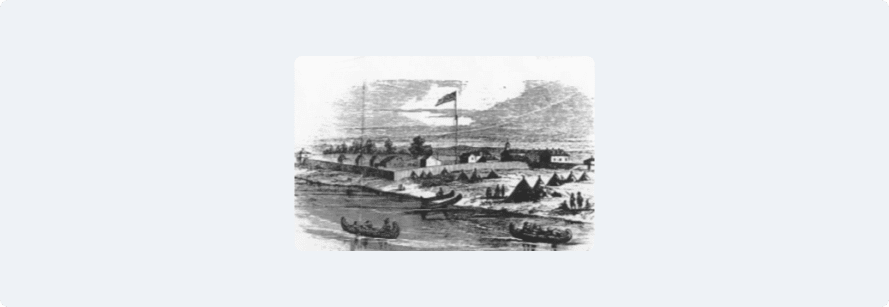
First Fort
After the War of 1812 ended and the Treaty of Paris was signed with Great Britain, the Falls of the Saint Mary’s River were left unoccupied, controlled by the British garrison stationed on Drummond Island. General Hugh Brady moved his troops from Sackett’s Harbor to Sault Ste. Marie in 1822 to construct a stockade and barracks on the land ceded by the treaty of 1820 to the Chippewa Indians. Brady first took over the former Nolin house and began the erection of a stockade, with blockhouses at the southwest and northeast corners. Pickets twelve feet high set four feet in the ground enclosed the principal buildings of the post in a solid stockade. Fort Brady was completed before the close of 1822 and stood on that location until 1892 when it was moved to Ashmun Hill.
Sault Life Revolved Around Fort Brady
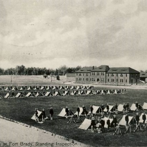
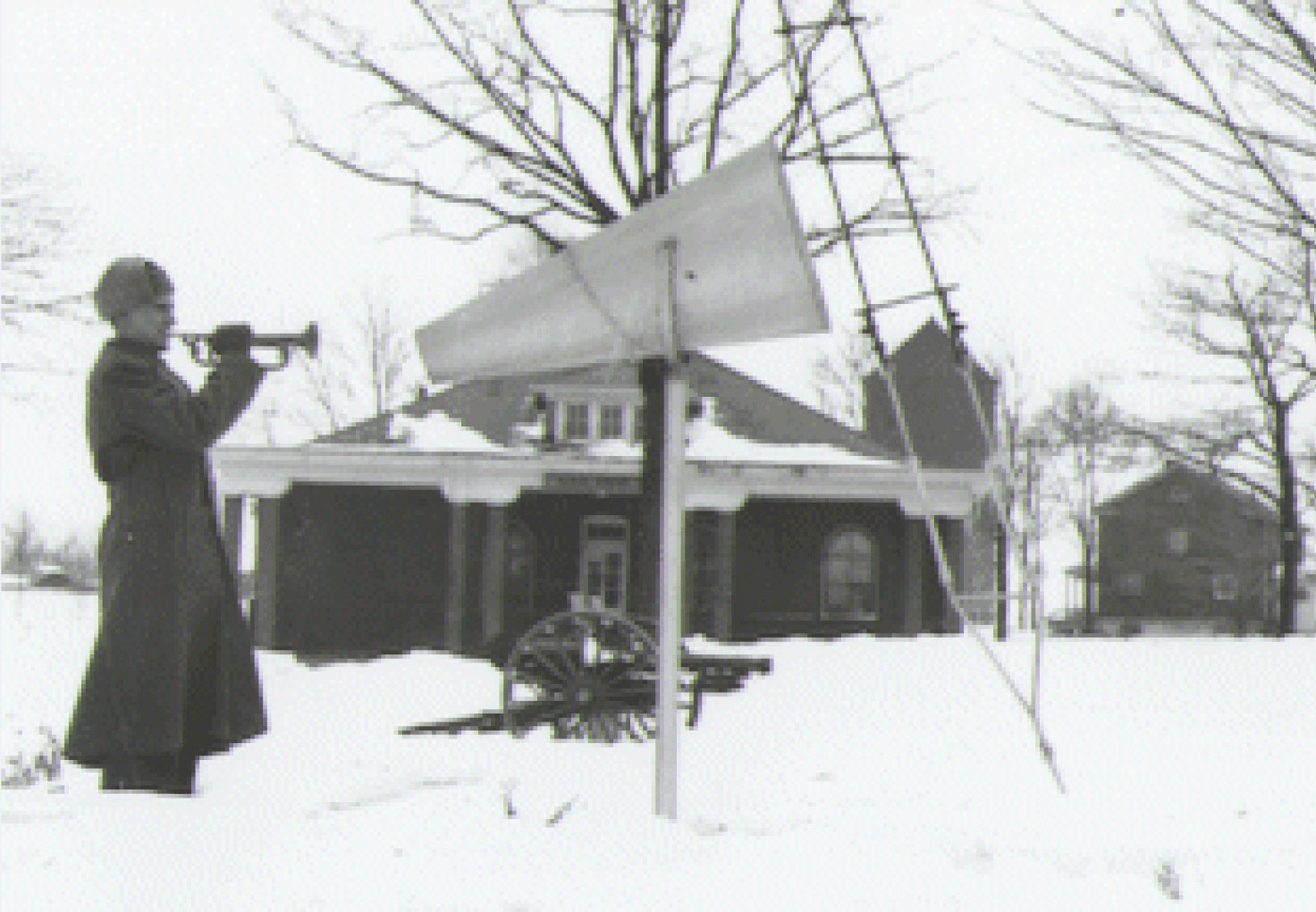
Fort Brady was very important in the life of Sault Ste. Marie, occupying 26.14 acres extending 550 feet along the bank of the river and running parallel to Portage Street. The fort had a large garden, a cemetery, and a grove of large trees lying south of Portage. The main entrance was located on Portage Street, where a sentry with a rifle would pace back and forth. Just inside the entrance and to the right were long piles of cordwood used for heating the fort buildings because little, if any coal was used for heating. On holidays people would gather to watch the soldiers parade down Portage Street. The cannon would be fired and bugle calls called at random. Every spring activities were held at the fort including foot races, horse races, dog races, and canoe races. The races would take place on Water Street and at the base of the Saint Mary’s River, starting at Sugar Island. Indian men frequently defeated American soldiers in canoe races.
Second Fort
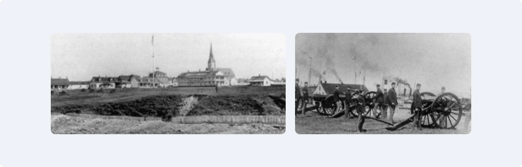
The federal government realized Sault Ste. Marie was an open target for sabotage and was a possible place to stage an invasion into the country and in 1866 ordered federal troops to occupy the base and return it to active duty. The fort buildings were rebuilt and remodeled. The federal troops were stationed here to protect the state locks and canals.
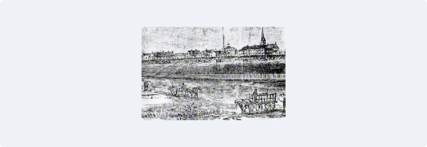
Third Fort (Fort Brady)

The decision to construct Fort Brady III was made on August 26, 1852, granting land to the state of Michigan. The land consisted of the right of way through Fort Brady military reservation and 75,000 acres of land to build the Weitzel Lock and Canal. The canal was to be 100 feet wide and 12 feet deep and the lock 60 feet wide and 250 feet long, with a depth of 12 feet. The lock and canal would be defended by the National Guard and monitored by Fort Brady upon the hilltop.
1880 – Move of Fort Brady
Fort Brady was moved to Ashumn Hill in the late 1880s and early 1890s. The construction began in 1892 and lasted through the turn of the century.
1893 - Public Auction of Second Fort Brady
In 1893 a public auction was held for the Old Fort Brady Military Reservation. The sale would include sixty-two (62) building lots and the greater part of the reservation. The government wanted cash and would give the fort to the highest bidder. Before the auction started an Auction Sale sheet was handed out that contained a map of the sites for sale and a description sheet. Some of these buildings are still in use today.
1894
In 1894 Fort Mackinac was closed and Fort Brady became the only fort in Northern Michigan still in operation. The soldiers and supplies from Mackinac were diverted to Sault Ste. Marie.
1898
In 1898 2,000 troops were stationed at Fort Brady for military training before being sent to Cuba for the Spanish-American War.
1930
In the 1930s a barracks for WACS (Women’s Army Corps) was constructed as well as a gym and ammunition bunkers south of the fort.
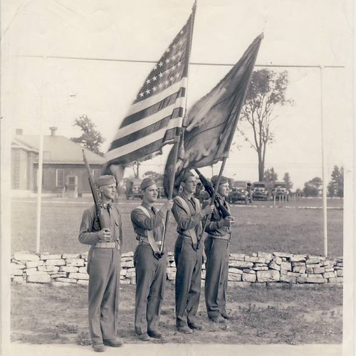
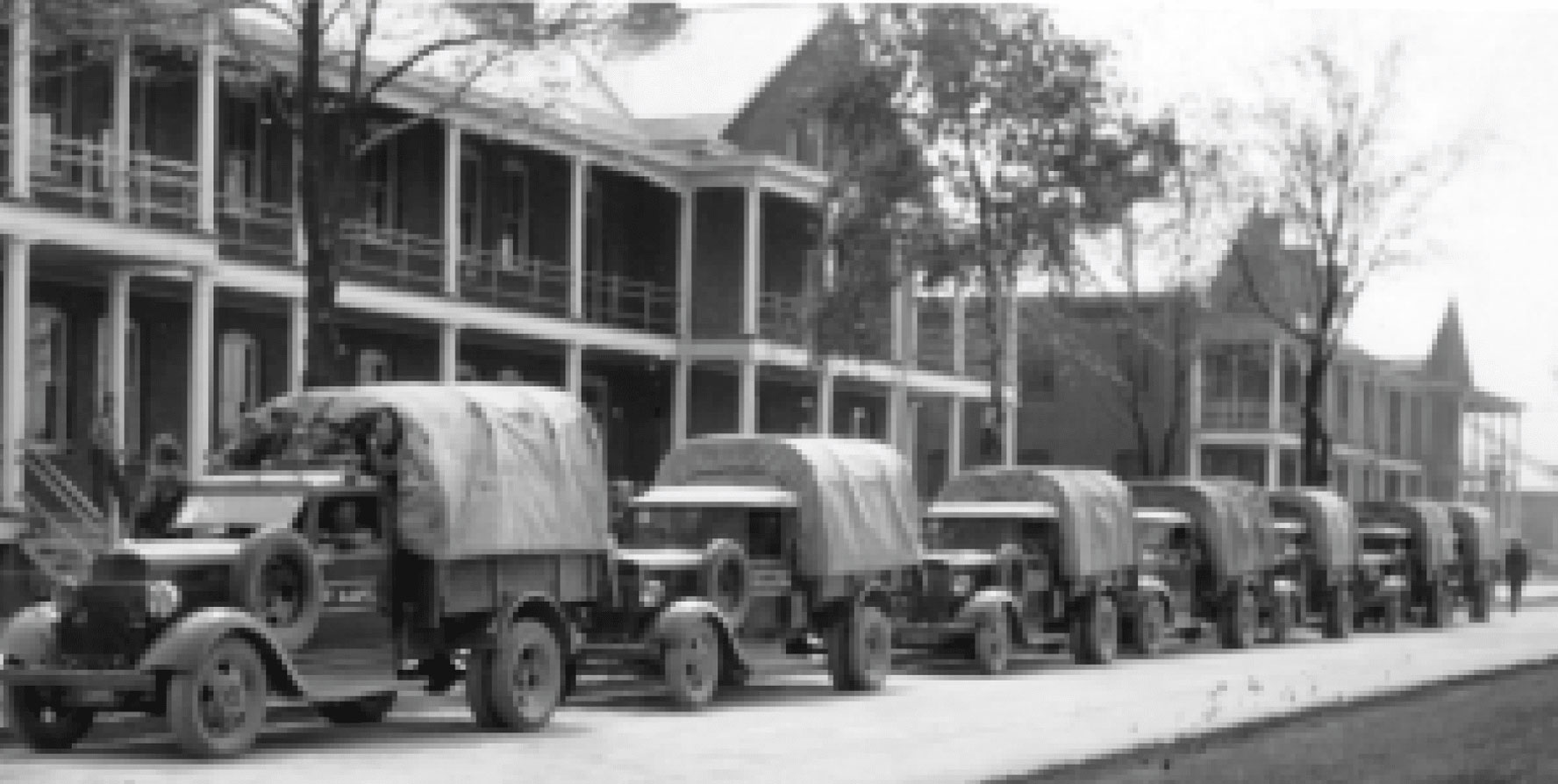
20,000 Troops Stationed at Fort Brady
During World War II 20,000 troops were stationed at Fort Brady. A tent city was built and temporary wooden structures were constructed to serve as various warehouses, shops and offices. A heavy security fence was placed around the fort and access was limited to one main gate.
World War II at Fort Brady
During World War II the fort was the main life of the Sault.
March 1, 1944
Fort Brady reclassified as a class I installation from class II.
April 5, 1944
Fort Brady declared a surplus fort.
August 31, 1944
Hospital facilities are outleased to the State of Michigan.
November 25, 1944
Fort Brady placed in Inactive Status.
Troops Shipped Out
In the latter part of 1945 troops were moved out from the fort, causing a drastic decline of the Sault Ste. Marie population. The locks and canal were now under the protection of the National Guard, activated in the Sault in 1894.
Fort Brady Sold for School Use
After the Mexican War the Michigan National Guard joined Wisconsin to form the Thirty-Second Division (the Red Arrow,) one of the great fighting divisions of World War II. After the National Guard returned, the Fort was sold to the State of Michigan for the Mining and Technology College in 1946.
In 1966 the school became the site of Lake Superior State College of Michigan Technological University. The college became a separate entity in 1970 and received university status in 1987, at which time Lake Superior State University was the smallest public university in Michigan.
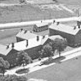
Fort Brady
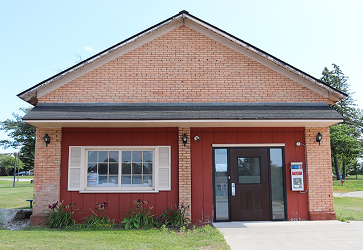
Fort Brady Entrance
The main entrance of Fort Brady was through the east gate. The east gate and Gate house were built in 1921 to shelter guards during fort operating hours. Today the gatehouse is used for electrical switching equipment.
While on active status, the grounds of Fort Brady were surrounded by twelve-foot fencing. Guards were stationed outside the fence at the east gate and at the Easterday Avenue exit.
A second, smaller entrance was located in the fencing along Easterday Avenue. This entrance made a loop around South Hall, where trucks would drop off soldiers and supplies. These trucks would park in front of the old Auditorium which burned down in the early 1960s.
Post Headquarters
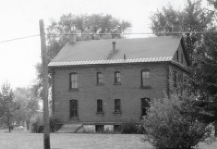
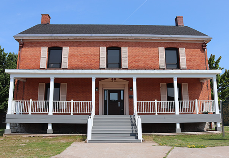
Brown Hall was built in early 1900s to house officers and to be the site of the post headquarters. It was first used by Lake State as the counseling center. Once the counseling center moved to South Hall, Brown Hall became the site for Lake State’s Fine Arts Academy, with staff offices, studios, and music practice rooms.
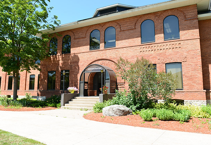
Post Office / Administration Building
Lake State’s Administration Building was built in 1920 to be used as the fort post office and to house quartermaster soldiers.
In 1946 it was remodeled from barracks to offices. During the renovations offices were built and the mail room was modernized. Today the Administration Building hosts the Offices of the President, Provost, Employee Relations, Central Switchboard, Campus Security and the main mail room for campus.
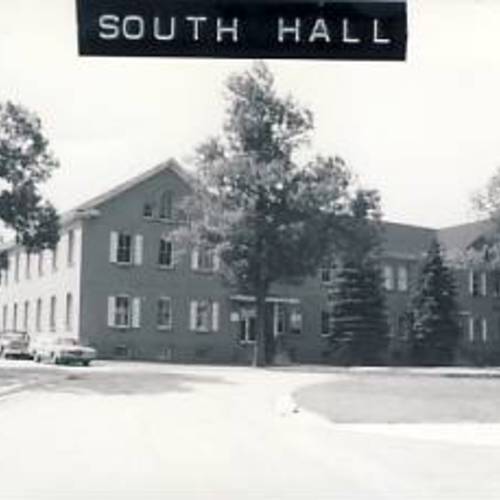
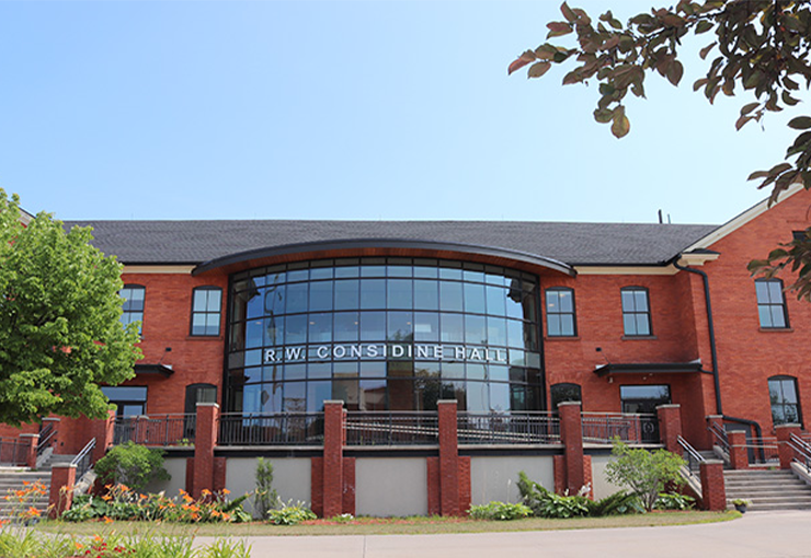
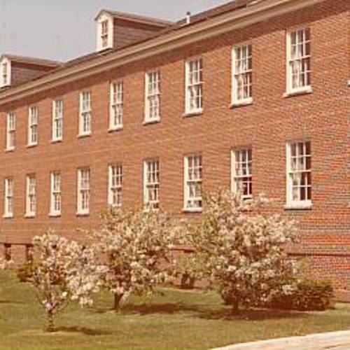
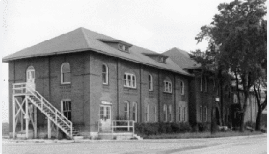
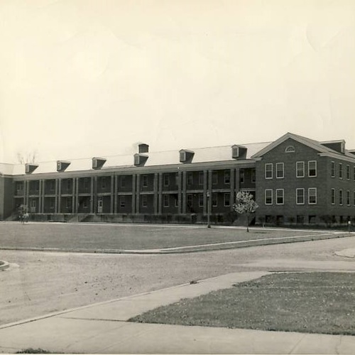
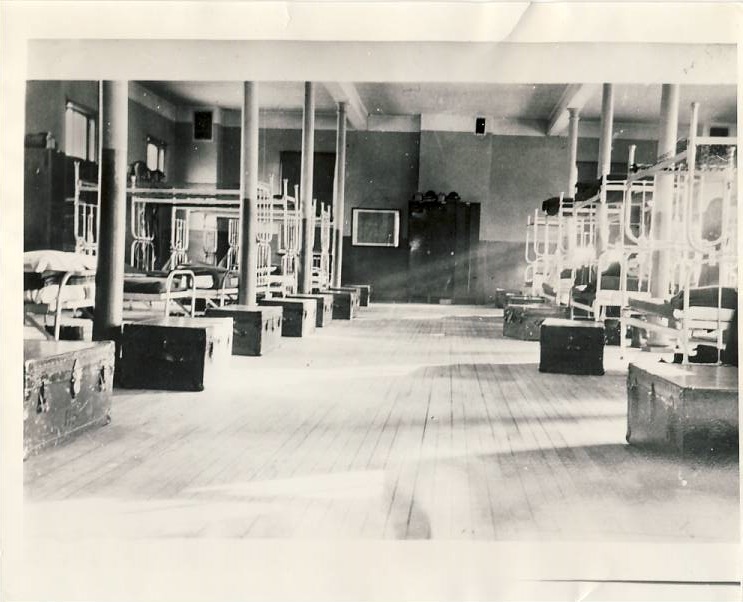
South Hall
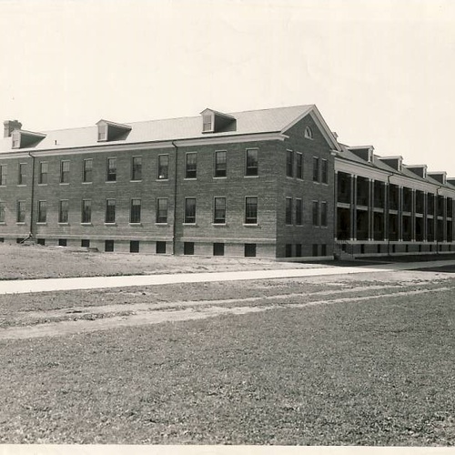
South Hall was built in 1903 to house Fort Brady’s infantry soldiers. The infantry barracks were composed of twin buildings, one of which burned down in the early 1960s. Instead of rebuilding that section of the building a decision was made to build Crawford Hall, a new facility that would be adequate for scientific research. During the fire, the fort cafeteria, the structure connecting South Hall to its twin, was also destroyed
South Hall, now renamed R.W. Considine Hall.

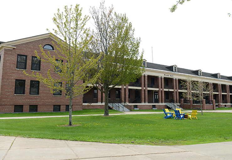
Brady Hall
Named in recognition of the fort’s original commander, Brady Hall was built in 1930s to serve as a barracks for WACS. When Fort Brady was recommissioned as Lake Superior State University the barracks were transformed into a men’s residence hall.
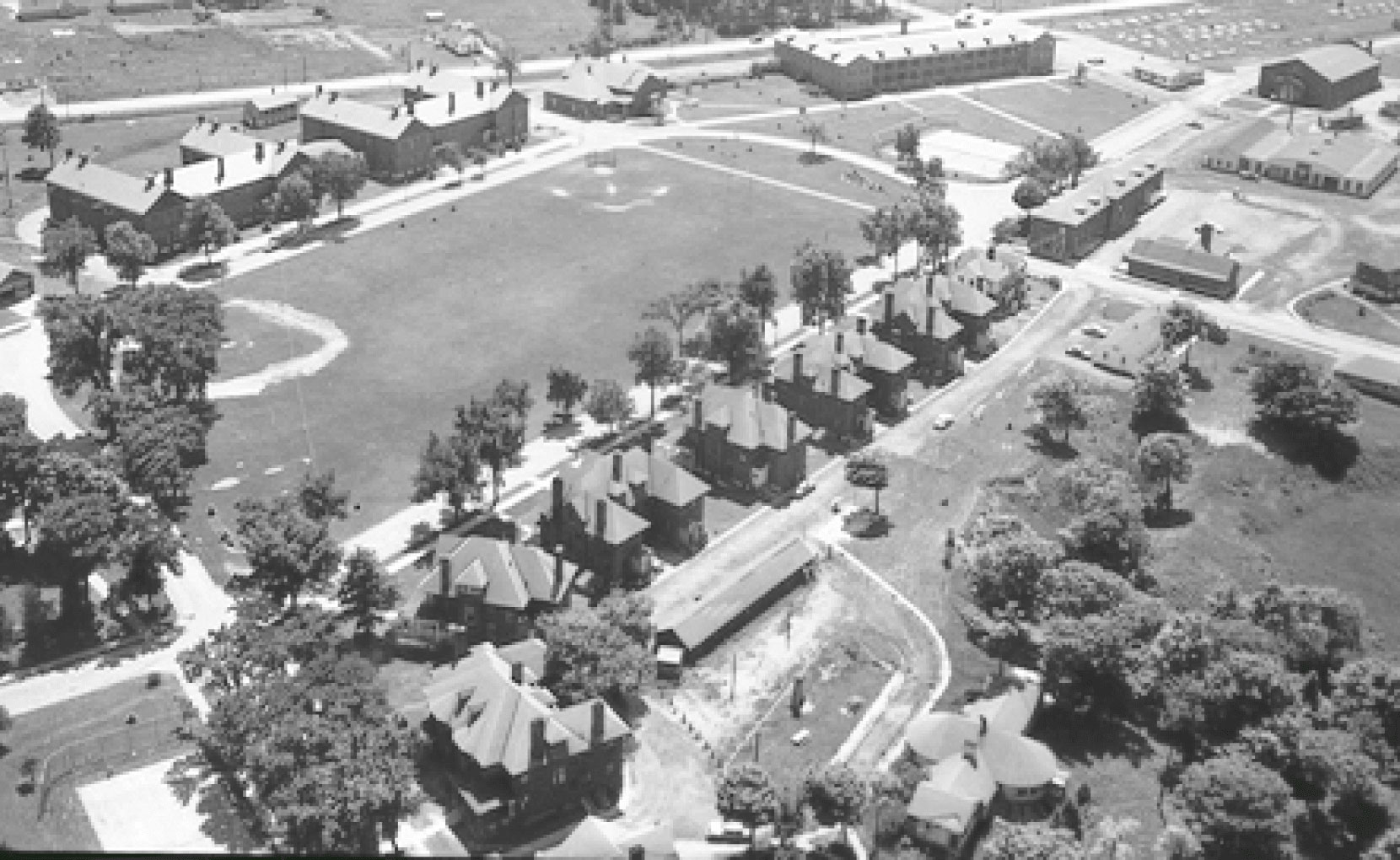
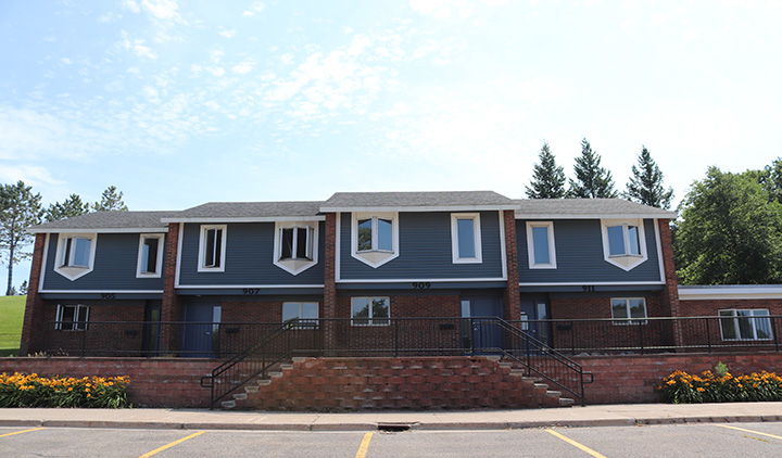
Row Houses
The row houses were built in the 1890s or early 1900s to house army officers and families. The President’s House was once home to the commanding officer and his family. Today these structures are home to student housing, the Honors Program, Native American Center, Admissions Office and the Alumni Association.
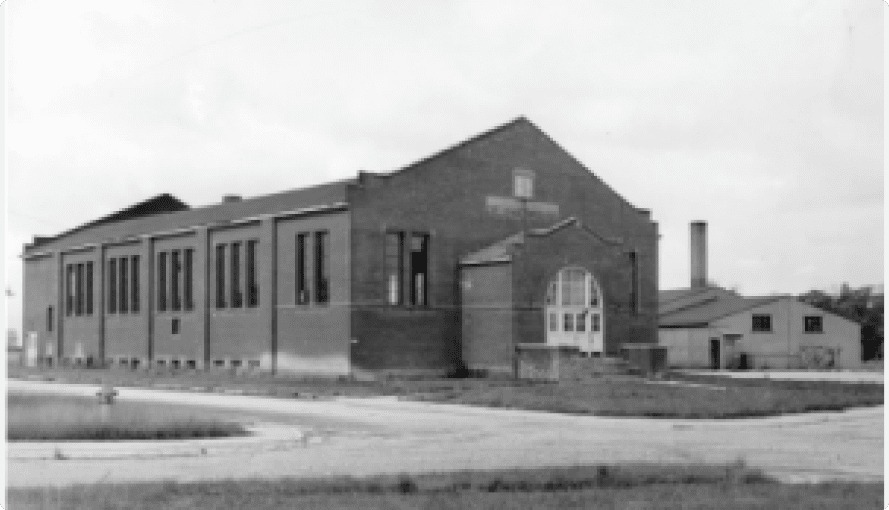
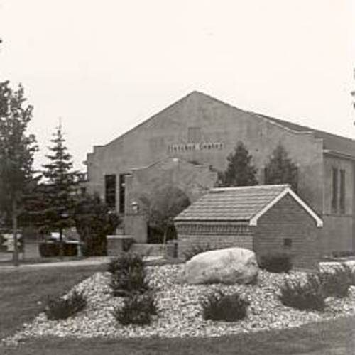
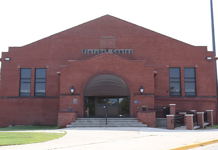
Fletcher Center
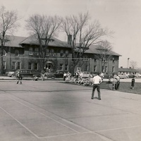
Fletcher Center was build in the 1930s as a gym. When the fort was converted to a university in the gymnasium was used for sports events, dances, and other school functions. The building was used as a gymnasium until 1976 when the Norris Center was completed. Since then Fletcher has housed business offices, including Business Operations, Student Services, Financial Aid and the Registrar
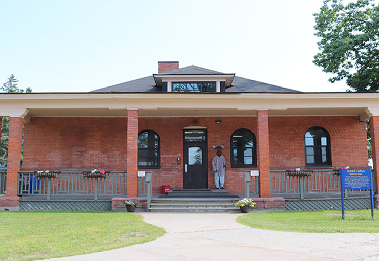
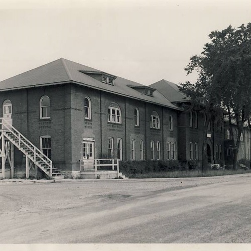
Stockade
East Hall was built in 1890s for use as the post guardhouse and stockade.
Firehouse
Fort Brady’s fire house was built in early 1900s.
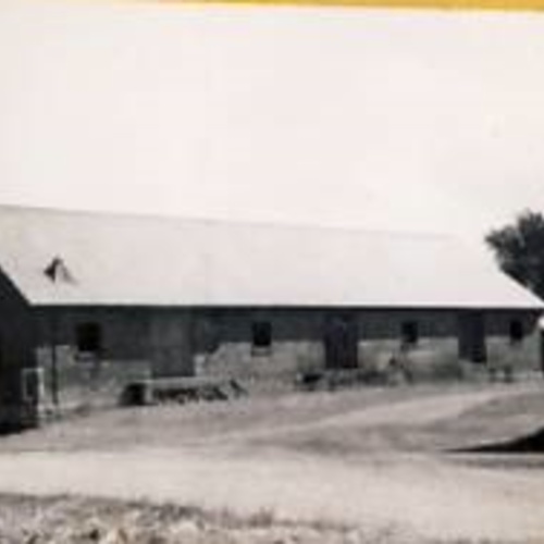
Lost Buildings
Officer’s Recreation Center
The recreational center was used by soldiers for entertainment purposes. Once the fort was converted to a university, the recreation center was used by students for dances and sporting events, until it burned down. A storage facility now stands in its place, used by students living on officer’s row.
Library
The fort library was used as a library for one year after the fort was converted to a campus for Sault Branch and then converted to married student apartments. After being housed in South Hall for many years, a new library building was built in 1971 and named after Dr. Kenneth Shouldice, who is credited with transforming Lake Superior State college into the University it is today.
Warehouses, Hospital, Shops
The warehouses, hospital and machine shops were eventually replaced by the Cisler Center, CANUSA Hall and CASET Building. After the fort was bought by the state of Michigan the buildings were used for classrooms and storage facilities. The machine shops were used for heavy machine laboratories and drawing laboratories for engineering students. The hospital was used for chemistry, history, political science and geology classes and offices.
South Hall’s Twin & Cafeteria
The infantry barracks were composed of twin buildings, one of which burned down in the early 1960’s. Instead of rebuilding that section of the building a decision was made to build Crawford Hall, a new facility that would be adequate for scientific research. During the fire, the fort cafeteria, the structure connecting South Hall to its twin, was also destroyed.
Auditorium
An auditorium was built for Fort Brady in 1939 for use as a classroom for troops stationed there. The auditorium was used by the university until it was destroyed by fire in the early 1960s. Crawford Hall was built in its place.